Si Phan Don and the South
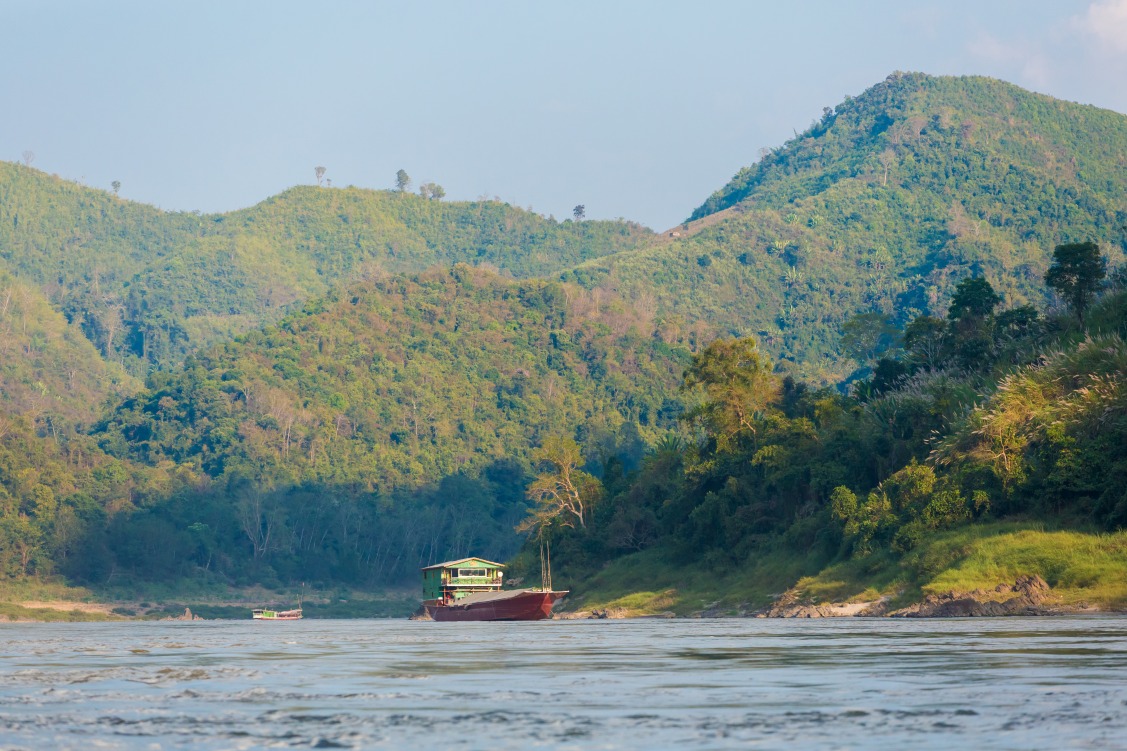
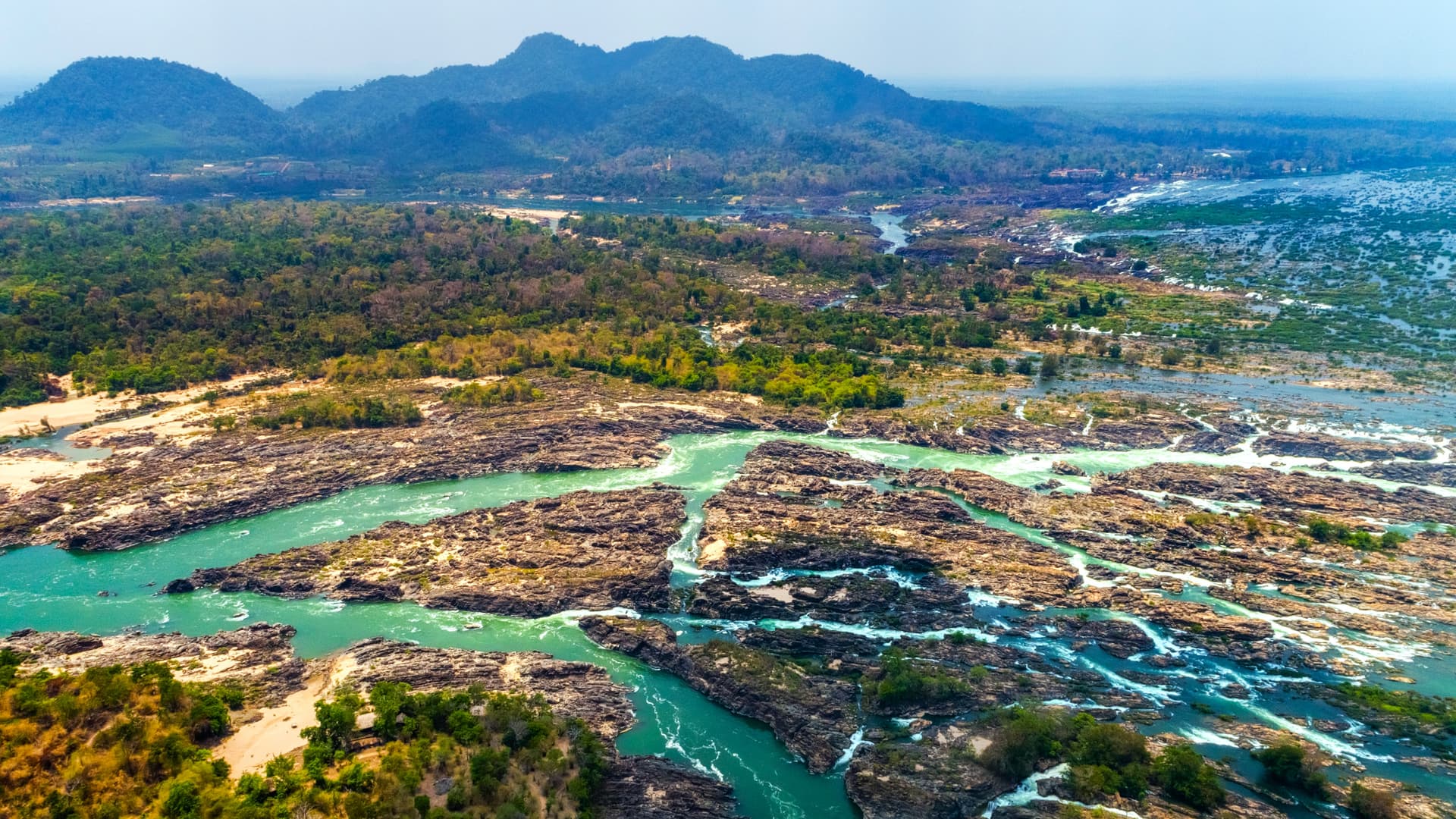
In the south, the Mekong widens into an archipelago of 4,000 islands before hitting the Khone Phapheng Falls, in a plain watched over by the Khmer sanctuary of Vat Phou.
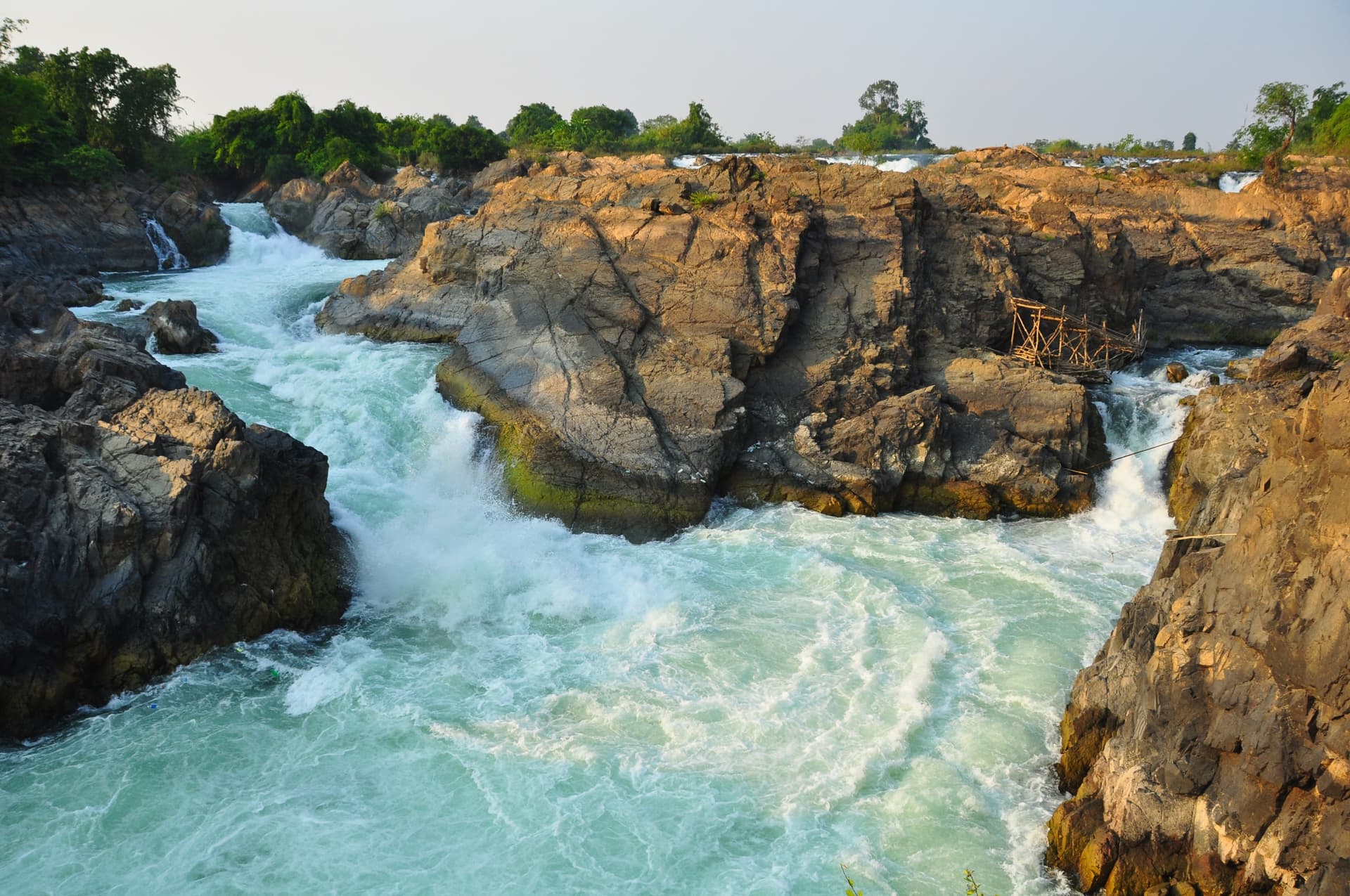
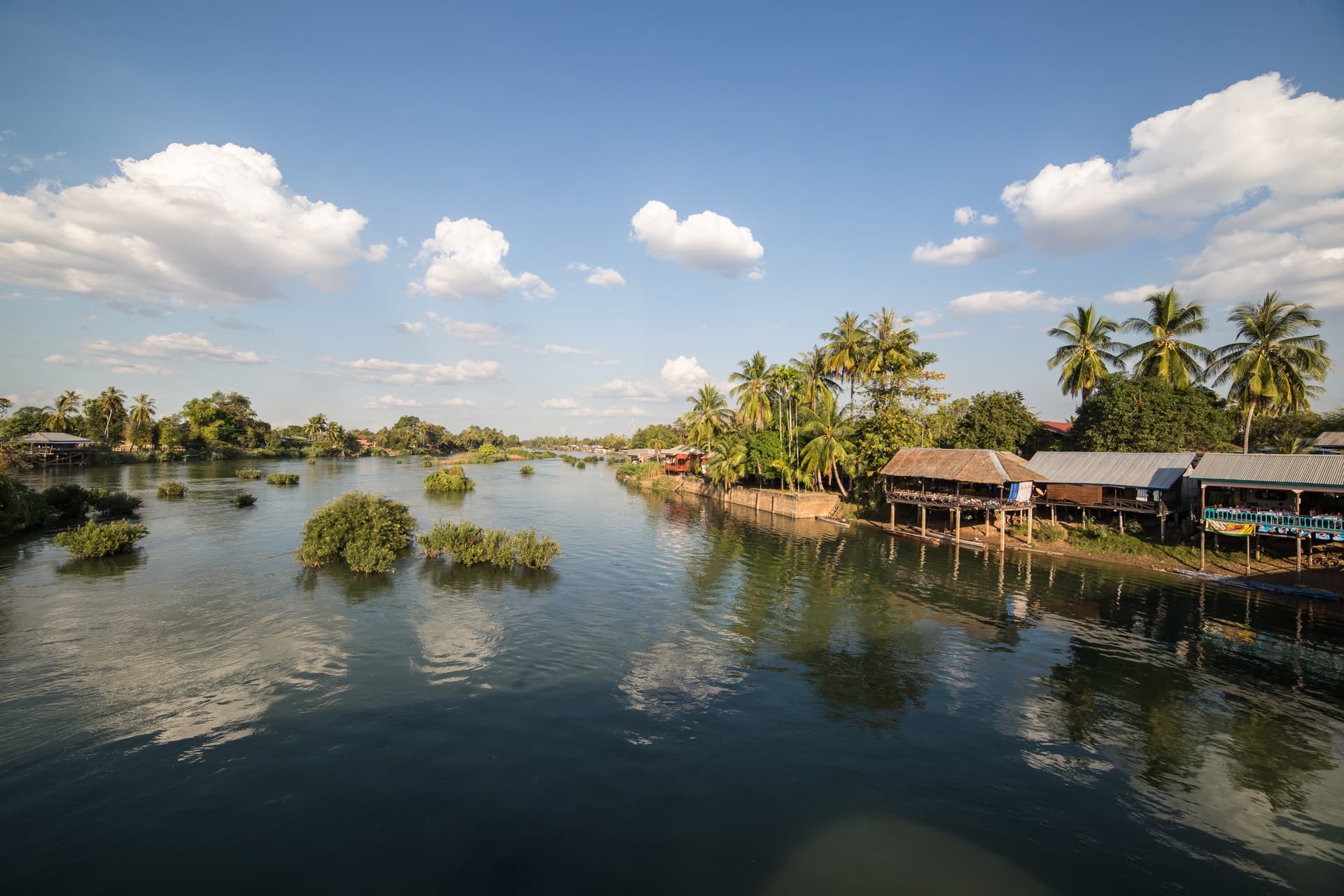
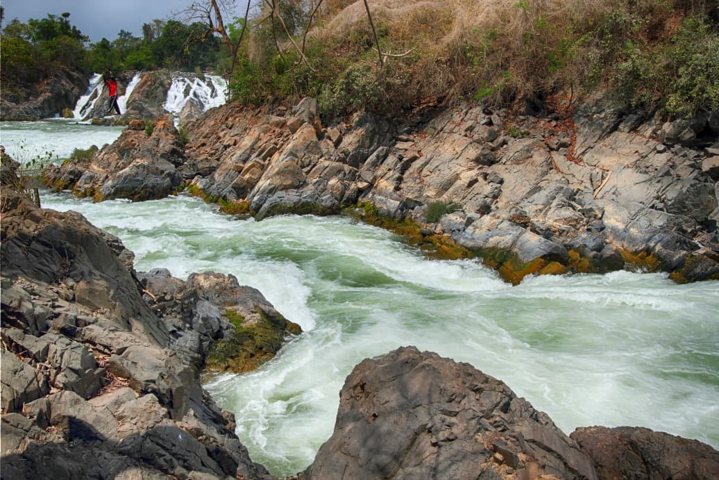
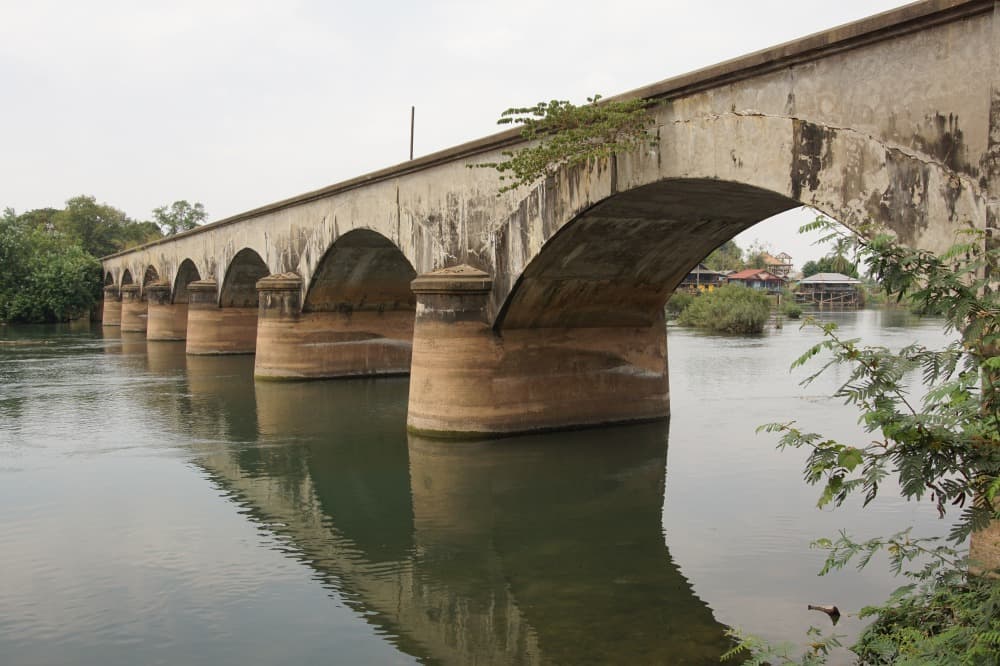
Southern Laos begins for us somewhere after Paksé, when the road leaves the foothills of the Bolovens plateau and descends back toward the Mekong plain. The river here bears no resemblance to the narrow waterway you cross at Luang Prabang: it spreads out, slows down, divides. At the Cambodian border, its width reaches 14 kilometers during the rainy season and it fragments into four thousand islands, the Si Phan Don, before hitting the rocky barrier of Khone Phapheng Falls, impassable to navigation. It is this geological lock that explains the region's recent history: the French built a 7-kilometer railway at the end of the 19th century linking Don Det to Don Khone to bypass the rapids, where you can still see rusted locomotives and the metal bridge between the two islands.
Champassak Province, which encompasses most of the south, is populated by lowland Lao Loum, rice farmers, but also by Mon-Khmer communities settled in the highlands of the Bolovens and along the Vietnamese border. Champassak town, the former capital of a distinct kingdom between 1713 and 1946, preserves a few colonial houses lined along the single avenue bordering the river. About ten kilometers to the south, the Khmer sanctuary of Vat Phou, inscribed on the UNESCO World Heritage List in 2001, predates Angkor by several centuries: its earliest structures date from the 5th century, most of the visible structures today from the 11th century. The sanctuary is backed against Mount Phou Kao, whose peak in the shape of a natural lingam likely explains the builders' choice of site. The annual Vat Phou festival in February, at the full moon of the third lunar month, attracts pilgrims from throughout southern Laos and northeastern Thailand.
Further south, the Si Phan Don archipelago is organized around three main islands. Don Khong, the largest (18 km long), remains agricultural and relatively untouched by tourism: villages like Muang Khong or Ban Hin Siew live off rice, fish, and water buffalo breeding. Don Det concentrates backpacker accommodation in the north of the island, while its neighbor Don Khone, connected by the French bridge, retains a quieter character with its temples and former colonial administrative buildings. Between the islands, fishermen still set li, bamboo traps installed in the rapids to catch migratory fish during the dry season.
The deep waters south of Don Khone, near the village of Ban Hang Khone, shelter one of the last populations of Irrawaddy dolphins in the Mekong. Recent counts indicate around thirty individuals shared with neighboring Cambodia. We organize observation by motorized boat from Ban Nakasang or Ban Hang Khone, generally in late afternoon when the dolphins come up to breathe in the deep basin. The outing lasts about an hour and remains dependent on river conditions.
The economy of the south is based on lowland rice, fishing, and increasingly on arabica and robusta coffee cultivated at altitude on the Bolovens, immediate neighbors. The markets of Paksé, notably Talat Dao Heuang along the Sedone, mix Laotian products with Thai merchandise crossing the Friendship Bridge II. On the cuisine side, the south stands out for its taste for bitter and fermented flavors: tam mak hoong is spicier here than in the north, padaek (fish sauce) more prevalent, and or lam, a thick stew made with buffalo meat, bitter eggplants and sakhan wood, actually originates from Luang Prabang but appears on Champassak tables.
Must-see
Vat Phou and Mount Phou Kao. Pre-Angkorian Khmer sanctuary tiered in terraces up to the sacred spring, to be visited early in the morning before the stone heats up. Hundred-year-old frangipani trees line the 250-meter processional avenue.
Irrawaddy dolphin watching. Boat trip from Ban Hang Khone, south of Don Khone, in the border basin with Cambodia. Around thirty individuals remain, observable in late afternoon when the river calms.
Cycling on Don Khone and Don Det. 30 kilometers of flat tracks between rice paddies, sugar palms and old French railway ruins. Crossing the 1910 metal bridge connects the two islands in minutes.
Khone Phapheng Falls. The largest river flow in Southeast Asia, particularly spectacular in August-September when the Mekong is at its peak. The rocky barrier extends nearly 10 kilometers diagonally across the river.
Champassak morning market. Village market where fishermen bring their Mekong catch before 7am: catfish, local carp, sometimes eels. Vendors prepare khao jee pâté, Laotian sandwich inherited from the French period.
When to visit
The best time to visit the south runs from November to February: temperatures between 20 and 30°C, clear skies, river still high after the monsoon. December and January are the driest and most pleasant months for cycling in the islands, with cool nights occasionally on Don Khong (16-18°C). From March to May, heat becomes oppressive, reaching 38°C in Paksé in April, and agricultural burning in the region and northern Cambodia fills the air with persistent haze that reduces visibility, including over Vat Phou.
The monsoon runs from June to October, with a peak in August-September (monthly totals exceeding 300 mm). This is paradoxically when the Khone Phapheng and Liphi Falls are most impressive, the Mekong then carrying up to 50,000 m³ per second. On the downside, some island tracks become muddy and dolphin watching becomes more hit-or-miss, with turbid water complicating detection. We advise against July-August for travelers primarily interested in Vat Phou: the stone becomes slippery and stairs to the upper sanctuary are sometimes closed.
Practical tips
We recommend devoting a minimum of 3 full days to the south: one day in Champassak and Vat Phou, two days in Si Phan Don to enjoy the island pace without rushing. Four to five days allow you to add a loop through the neighboring Bolovens plateau, a logical connection since both regions share Paksé as their gateway. Paksé airport receives direct flights from Vientiane (1h15), Siem Reap and Bangkok; the road from Vientiane via Savannakhet takes two days by land, not particularly relevant unless specifically interested in central Laos.
The south combines naturally with the Bolovens plateau (waterfalls, coffee plantations, Katu and Alak villages) in a 5 to 7-day loop from Paksé, and often forms the end of an itinerary descending from Luang Prabang and Vientiane. Continuing into Cambodia is possible by land via the Veun Kham-Trapeang Kriel checkpoint, 30 minutes from Don Det, making it a coherent transit point for a regional journey. Hotel comfort remains modest on Don Det and Don Khone (guesthouses, a few boutique hotels), more established in Champassak and Paksé. The region suits contemplatives, Khmer archaeology enthusiasts and families with children from 7-8 years old, cycling in the islands being accessible and safe.